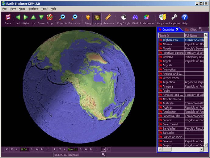
Earth Explorer DEM is a 3D earth globe software that combines high resolution shaded relief topographic imagery and various map information with 1km digital elevation model to create an immersive experience.

The software is very user-friendly and allows the user to specify what kind of map layers they would like to view, rotate the globe and zoom in/out using the right mouse button. The software also has a measure distance feature and allows the user to observe our beautiful planet from any point.
The software integrates with several kinds of map layers like vector map layers (political boundaries, coastlines, lakes, islands, rivers, longitude-latitude grids) and point map layers (267 countries/regions with detailed information, 40,000+ ranked cities with information, 15,000+ islands with information and 1,700+ noteworthy historical earthquakes since 1980 with detailed information).
The software offers three kinds of operation modes (Drag, Center, Measure) and users can measure the distance between any two points on the globe. The software has an intelligent tip feature which offers information when the mouse hovers over a country/city/island/earthquake mark or name label. The table can be sorted according to selected titles and interactive operate with the label and mark on the map.
With the newly redesigned interface and configuration utilities, Earth Explorer DEM works well under the Windows 98/ME/NT/2000/XP systems. The software also allows users to save favorite maps with BMP, JPEG formats. Overall, Earth Explorer DEM 2.5 is an amazing software that offers high-resolution imagery and map layers to help users explore our beautiful planet.
Version 3.5: Improved location list display and the ability to add user's location list.
Version 3.01: Day/Night Effect; Full Screen Mode; Other Settings
Version 3.0: Day/Night Effect; Full Screen Mode; Other Settings