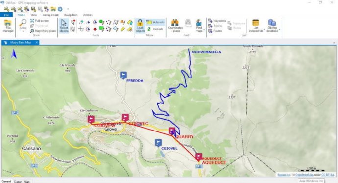
OkMap is a mapping software that organizes paths using custom waypoints, routes and tracks. It enables real-time GPS navigation and compatibility with vectorial and raster maps, including those scanned or purchased. It allows data upload and download to GPS devices.

This software also uses altitude DEM data and supports GPS real-time navigation. You can easily send/receive vehicle positions and display tracks on maps in real-time. Additionally, OkMap provides autorouting and geocoding functions, making it easy to integrate with Google Maps/Earth (in 3D). With all of these features, OkMap is perfect for a wide range of potential uses, such as search and rescue, trekking, off-road exploration, boating, flying, mountain biking, geocaching, hunting and fishing, finding mushrooms, and soft air adventures.
OkMap has many powerful features that make it a great tool for anyone who needs to work with maps or GPS data. You can calibrate raster maps with different cartographic projections and even create your own digital maps by importing/drawing shapes. Additionally, you can create and manage waypoints, routes, and tracks in GPX format and download, save, and automatically georeference maps from Google Maps. OkMap also supports autorouting, geocoding, and inverse geocoding functions, and uses digital terrain models to store and display elevation.
This software also allows for easy data exchange and integration with other programs. You can upload/download data to/from GPS devices, navigate in real-time through NMEA protocol, and display Google Earth and Google Maps in your current map location. Additionally, you can exchange data with gpsgate.com server, receive navigation data from remote GPS devices, send the current position to an OkMap remote server, and make conversions between coordinates, datums, formats, and more.
OkMap supports a wide range of formats for images, maps, vector data, GPS data, and DEM data. For instance, you can work with images in formats like ECW, BMP, GIF, JPG, PNG, TIF, and more. Additionally, maps can be in formats like file world, ECW, GeoTiff, KML/KMZ, JNX, OziExplorer, CompeGPS, GPSTrackMaker, RMap, MBTiles, OruxMaps, GpsTuner, and more. You can also work with vector data in SHP and DCW formats, and GPS data in GPX, CompeGPS, EasyGPS, Fugawi, Garmin, Geocaching, Google Earth, GPS TrackMaker, OpenStreetMap, OziExplorer, and more. Finally, DEM data can be in HGT (SRTM-1 and SRTM-3) format. Overall, OkMap is an excellent GPS and map software that offers a wide range of features and capabilities for various needs.
Version 16.1.0: N/A