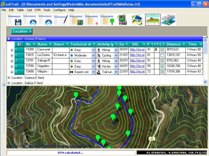
This software allows users to effortlessly create, edit, display, and manage trails and routes. The user interface is simple and flexible, featuring data tables for trail management and integration with popular mapping providers such as Bing, Arcgis, Ovi, and Yahoo. Importing and exporting capabilities are also included.

The presentation on the map is another key feature of this software, which displays maps in accordance with the active trail. This includes provider maps such as 'Satellite' mode (photos, orthophotos, etc) and 'Map' mode (Topographic map, street maps, etc). The digital terrain model (DTM) is also included with the software, offering users the ability to download all files, patches, with elevations of a point every 90 metres from around the world and 30 meters for the United States, (DEM, digital elevation model), taken by the 'Shuttle Radar Topography Mission', SRTM.
Additionally, the software offers a longitudinal profile tool, allowing users to view profiles with direct and reciprocal relationships with the TrackPoints and WayPoints of the active trail. Users also have access to a powerful trail editing tool, which allows for the creation, modification, joining, splitting, and deleting of trails graphically. All of these actions can be completed with the click of a button on the map.
With regards to display and management of photographs, the software includes an image viewer that allows users to easily view and rotate photographs as needed. Furthermore, the software works seamlessly with AutoCAD/Bricscad/ZWCad, allowing users to draw trails, waypoints, digital models, maps, contouring, and a cloud of points within these software platforms. This enables users to have their trail in UTM XYZ WGS84 coordinates, allowing for inclusion of new maps of any active WMS service, (Warehouse Management System), and above all, with CAD tools.
Version 1.0: New version