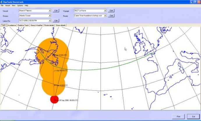
This software monitors global weather, including storms and typhoons, and displays their paths based on user location or route of travel. It also provides avoidance routes and strategies for handling severe weather conditions.

Developed primarily for merchant vessels, this software is also vital for anyone dealing with weather conditions that are associated with tropical storms, including yachts, and other watercraft, etc. Its clear and easy-to-use overview charts reveal the forecasted track of the storm, its stormfield, and the available options for avoidance routes.
Furthermore, it provides you with a comprehensive understanding of the tactics you can use in heavy weather situations. If you are unsure, this software can calculate the risk of synchronous or parametric rolling, broaching, or flooding. Thus, it can determine dangerous course and speed settings, which are displayed on the various charts.
This application also comes with a database that is compatible with other recent NavTools applications and NavTools Route 7 voyage planning, which is soon to be released. Overall, this software is easy to use, efficient and will prove to be an essential tool for those dealing with tropical storms.
Version 6.12: Major new release