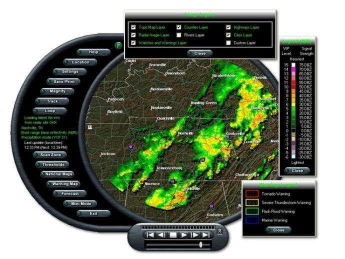
StormPredator is a software that provides NEXRAD doppler radar images on 3D GIS topographic maps. It offers a unique GPS storm tracker & predictor tool, personal scan zone, and distance measuring tool. It also alerts via email, pager or cell phone.

One of the best things about StormPredator is its free radar images. It is like having your own personal live Weather Radar on your desktop that can warn you of approaching storms. It also features a state-of-the-art user interface with customizable skins and buttons for cool hi-tech and extreme looks. The software also features Radar Image Processing, ground clutter removal, automated storm analysis, and pop-up alerts.
StormPredator offers a range of alert options including email, pager, and cellphone alerts. It also comes with computer model-driven IntelliWeather Forecasts for over 60,000 US cities. The national and state level interactive radar, weather warning status map, and complete weather bulletins for your area are an added advantage. The software even includes GPS tracking on-screen.
Finally, StormPredator can send radar images to cellphones and has full-screen mode for use with TV output. In conclusion, StormPredator is a complete weather monitoring solution that offers personalized and customizable features to meet all your needs.
Version 3.6: Added GPS tracking support
Version 3.5: Added GPS tracking support
Version 3.24: added image processing and smoothing
Version 3.2: added image processing and smoothing
Version 3.11: added 3D topographic imagery, 9 new radar products
Version 3.10: added 3D topographic imagery, 9 new radar products
Version 3.02: added 3D topographic imagery, 9 new radar products
Version 3.01: added 3D topographic imagery, 9 new radar products
Version 3.00: added 3D topographic imagery, 9 new radar products
Version 2.60: N/A