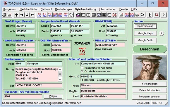
TOPOWIN is a topographic information system that serves as a comprehensive register for the German topographic cartographies and geo-referenced localities in various coordinate systems. It provides an efficient way to access and analyze topographical data across the country.

This program is designed to make official topographic cartographies and the German Basic Cartography from the entire national territory easily accessible in suitable graphic views. TOPOWIN is capable of accomplishing different coordinate transformations and inquiries, thanks to the cooperation of the land surveying authorities of many German Federal States.
TOPOWIN is a useful and versatile tool for consulting engineers, planning authorities, and users of topographic maps. It allows topographical maps of different standards required for a project to be determined by entering known parameters or by directly selecting them from overview graphics and sorted lists.
Moreover, the program provides access to a data base with over 105,000 places and residential districts. By investigating topographical records on the basis of known locations, users can access this valuable resource.
TOPOWIN calculates with Gauss Krueger coordinates and Geographic Coordinates referring to the Potsdam Datum (Bessel ellipsoid with central point Rauenberg). It also works with UTM coordinates and UTMRef coordinates in the NATO standard, referring to the datum ETRS89 (GRS80 / WGS84, geocentric). This software is an indispensable tool for anyone seeking accurate and reliable geographic information.
Version 20.01: Program is faster and more stable using a new development system. All databases actualized on 1st. January 2021. Territorial Reform in Thuringia of the year 2019 implemented. View of maps in OpenTopoMap, Google Maps, Google Earth. All map views supplemented with UTM edge coordinates.