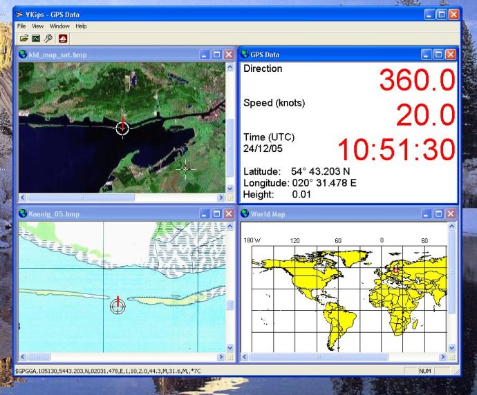
A GPS mapping software that allows users to display real-time GPS data and open scanned maps. It features an easy calibration process with just two points, and each map's calibration is automatically saved for future use.

Users can view their route line and speed direction on the maps. To use the software, users must connect their GPS device to their computer via the com-port. In the Properties Dialog, they will set themselves up with the comport's name and a Bits Rate (for example: COM1, 4800). Users will be able to see their position point on the world map and then proceed to open any scanned map file. They will need to point the left-top point at the map, and press the right mouse button to input coordinates for this point. They will repeat the process for a right-bottom point anywhere on the map to calibrate it. The map will display the user's position, speed, direction, and route line.
The software presents different options to help users navigate the software with ease. For new calibration of a current map, users will utilize the menu "View / Clear calibration Points." There's also a button "Show Route Line" for showing or hiding the Route Line, and a button "Show GPS Data" for opening up a GPS Data window. Users can open a lot of scanned maps, GPS Data, and World Maps together. The software has default settings for comport: COM1, bits per second: 4800, data bits: 8, parity: none, stop bits: 1, flow control: hardware. To set up the comport (Name and Bits per second) and refresh time for active maps, users can use the Property Dialog. The GPS Data window can be maximized to show a speed and direction as big symbols (when they are sailing), and any calibrated scanned maps will always display the user's position, speed, direction, and route line.
Version 1.0: No changes