• Home
  • Popular Downloads
  • Contact Us
  • Submit

Softpile

Free Downloads

Main Navigation
  • Home
  • Windows
  • Mac OS X
  • Business
  • Desktop
  • Development
  • Education
  • Games
  • Internet
  • Multimedia
  • Utilities
Home » Windows » Multimedia » Image Editors » TRIANGULATION for AutoCAD

TRIANGULATION for AutoCAD

January 12, 2022
An add-on for AUTOCAD or BricsCAD, for the TRIANGULATION of a set of point, isolines, KML 2D and 3D creator, the VOLUME of a set of 3dface entities, loading of XYZ points files, surface flatness and sections.
TRIANGULATION for AutoCAD
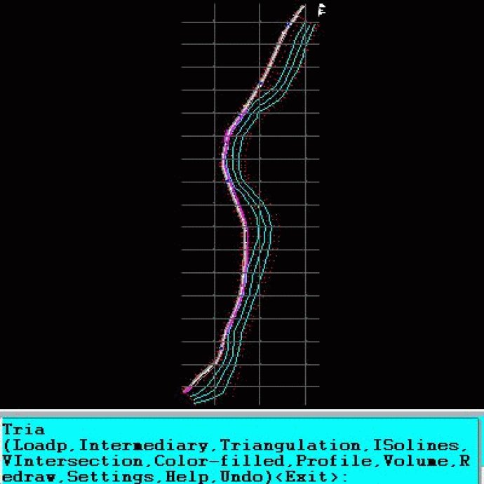
TRIANGULATION for AutoCAD Screenshot
Version: 2.3
License: Free To Try $47.00
Operating System: Windows
Homepage: rcad.eu
Developed by: Rcad Software
An add-on for AUTOCAD or BricsCAD, which makes the triangulation of a set of POINT entities, the intersection curves (isolines) between a set of 3DFACE entities and a set of equidistance plans, horizontally or vertically and the volume and center of gravity of a set of bodies or between surfaces composed of 3DFACE entities. You can also load and draw a file of points having the format: Number X Y Z Code.

The drawing of the XYZ files is made with POINT, 3DPOLY, SPLINE or BLOCK entities, according to a modifiable library of codes. The triangulation is performed on a convex hull of a set of points. You can triangulate million points! The isolines can be interpolated and their colors are according to a drawn legend.

The isolines having Z a multiple of a value will be drawn thickened. You can define a clipping parallelepiped for isolines.

You can also make the projection over a triangulation of a 2D POLYLINE and generate cross sections and a longitudinal profile corresponding at projection. The POLYLINE may contain arcs. Color-filled contour maps can be also generated.

In addition, you can draw a DWG file in Google Earth, by generating a 2D or 3D KML file type. The DWG file can be in any projected coordinate system and from any part of the globe.

It is also possible to determine the flatness of the surfaces and you can import and export LandXML file type!
What's New

Version 2.3d: It can be purchased with a 1-year subscription.

Version 2.3: It exports 3D objects from DWG to Google Earth.

Version 2.2b: It also works on BricsCAD.

Version 2.2: It can also determine the flatness of the surfaces.

Version 2.1d: Discount price

Version 2.1s: It can also be purchased with 4 month subscription

Version 2.1: You can also import and export LandXML file type.

Version 2.0: It can draw a DWG file in Google Earth, by generating a KML file type.

Version 1.9.1: It can also generate a file of KML extension, the interface with Google Earth. It can also work on ZWCAD 2014 or 2015.

Version 1.9: It can also generate a file of KML extension, the interface with Google Earth.

autocad add-ons bricscad add color-filled contour map isolines kml 3d kml creator landxml sections surface flatness topography triangulation volume xyz file
Free Download 2.5M
0
  • Share on:

Sponsored

Categories

  • Image Editors
  • Multimedia
  • Windows

Related Downloads

Andrew's Plugins vol 1 (PC Plugins for Photoshop and others)
46 plugins for Photoshop (PC) and other applications such as psp - mix of ...
Fire3 for Photoshop
*Creates very beautiful and real-looking fire.*Flame consists of very lively ...
ReaThumbnails - thumbnails creator
Prepare images and create thumbnails for your web photo albums, thumbnail ...
AVTJet Impression Workshop
AVTJet Impression Workshop is a home photo creativity software that can create ...
Max Album Creator
Max Album Creator was designed to create the Video CD, Super Video CD and the ...
Copyright © 1999-2017 Softpile Free Downloads
  • Contact Us
  • Submit
  • Privacy Policy
  • Disclaimer
  • Terms of Use