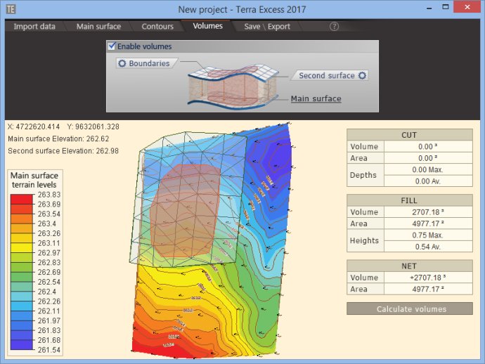
Terra Excess is user-friendly CAD software for land surveying and civil engineering tasks. It enables the creation of topographic plans, maps, and volume calculations of quarry, earthwork, and stockpile, as well as editing and viewing survey points.

Terra Excess's volumetric survey data feature allows users to calculate accurate volumes for stockpiles, quarries, and earthworks. The software creates a triangulated irregular network (TIN) for the surfaces and computes the volumes by using prism volume calculations, providing the most precise method for estimating volumes. The accuracy of the volume estimates depends solely on the quality of the entered data.
Additionally, Terra Excess lets you view and edit survey points with ease. They can be scaled in size, and some properties can be hidden, such as number, elevation or description. Finally, the software allows users to export points and contour lines in the DXF file format to transfer data between various CAD software products.
Overall, Terra Excess provides a comprehensive and intuitive package for surveying and civil engineering tasks, making it a must-have tool for anyone working in the field.
Version 25.1217: New Release
Version 25.1099: New Release