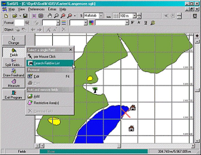
A software that manages fields with the support of GPS technology in a graphical interface.

I was particularly impressed with the EU conform Field Protocol, which ensures that all of our data is accurate and reliable. Additionally, the software enables us to produce true-to-scale prints in any scale we choose. This has made it much easier for us to share important information with clients, as we can now provide them with precise maps of their fields.
One of the benefits of this software is that we can manage all of our fields in a single farm map. This makes it much easier for us to keep track of everything, as we don't have to switch between multiple maps. The software also allows us to edit fields, split them as needed, and color-code them to differentiate between different areas.
Another feature that I found particularly useful is the ability to recognize restricted areas. This is important for us, as we need to ensure that we're not infringing on protected land. The software makes it easy for us to identify and avoid these areas.
The calculation of areas and distances is another handy feature. With just a few clicks, we can quickly determine the size of a field or the distance between two points. We can even add symbols such as trees, stones, and other objects to our maps, as well as text and freehand drawings.
Overall, I have been extremely impressed with this software. It has made our field management tasks so much easier and more efficient. I would highly recommend it to anyone looking to streamline their GPS measurements and field management processes.
Version 0.3.0.6: N/A