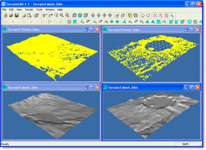
TerrainCAD is a terrain modeling software that uses TerrainLib algorithms to quickly generate and edit terrain meshes with precision.

The first capability, terrain generation, allows users to generate a terrain mesh from unorganized survey points, breaklines, and contours. This is done through a Delaunay Triangulation method, which creates a terrain mesh that accurately resembles the actual landscape being recreated. TerrainCAD can also create a terrain mesh directly from contours.
With terrain editing, TerrainCAD makes it easy for users to manually edit terrain meshes for various reasons. The software provides various terrain mesh editing commands, including ones for editing vertices, edges, and faces of a terrain mesh.
Lastly, terrain modeling commands allow users to alter the general topology of the mesh, making it suitable for further operations. This comprehensive software provides users with a vast array of tools and features designed to streamline terrain creation and editing.
Version 1.0: N/A