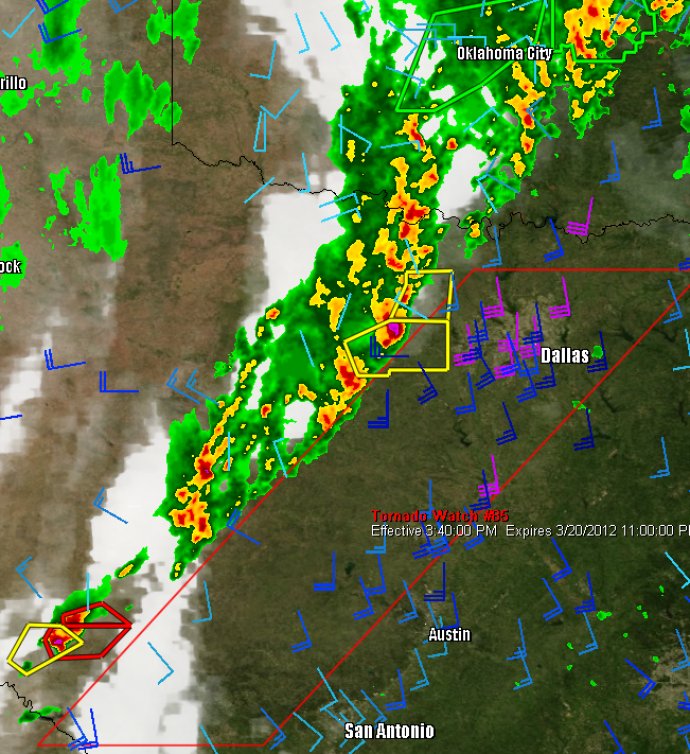
WeatherStudio offers a comprehensive selection of weather tools for professionals, enthusiasts, and everyday users. With hardware-accelerated functionality and GIS integration, the software provides a range of valuable products for storm chasers, meteorologists, mariners, and first responders on a single map.

One of the greatest benefits of WeatherStudio is the Partial List of Available Weather Data, which only represents about thirty percent of all layers and data available. The National Radar, National Satellite (Infrared, Visible, and Water Vapor), GOES East/West Satellite (Infrared, Visible, and Water Vapor), and Individual Radars can all be shown in either the latest scan or animated loop. Users can access a range of data, such as the Base Reflectivity, Composite Reflectivity, Long-Range 248-nmi Reflectivity, Storm Relative Velocity, Base Velocity, One-Hour Precip Totals, and Storm Total Precip Totals. Even the National Radar Loop / National Radar Archive Loop (going back to 1996), IR/Visible Satellite Loop / Archive Loop (going back to 2007), and Water Vapor Loop / Archive Loop (going back to March 2009) are available.
For those tracking severe weather, WeatherStudio offers an impressive range of data, including Storm Reports (Tornado, Hail, Wind), Severe Watches (Polygon and County based), Severe Warnings (Storm Based and County based), Convective Outlooks (Days 1, 2, and 3; Probabilistic and Categorical), Mesoscale Discussions, and Storm Attributes/Paths. Whether you are a meteorologist or a home user, this software provides unparalleled access to live weather data and detailed analysis that can help you make informed decisions during severe weather events.
Version 2: N/A