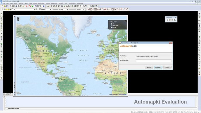
Automapki software integrates web mapping and satellite imagery with AutoCAD, ZWCAD, and Bricscad. With support for popular sources such as Bing Maps, Google Maps, Yahoo Maps, and Open Street Maps, users can display their projects in combination with their preferred web mapping source.

This software is designed to work with standard AutoCAD/ZWCAD/Bricscad platforms as well as any of their vertical products. Moreover, it supports over 3000 coordinate systems, enabling global CAD users to utilize any web mapping provider while creatively stylizing drawing entities.
Map projections and coordinate systems are usually quite challenging for designers, especially when they are dealing with an extensive customer base or when working on multiple projects that require different coordinate systems. Automapki simplifies such tasks by integrating popular satellite mapping services with AutoCAD/ZWCAD/Bricscad software.
Now, designers can easily switch between any of these web mapping providers depending on their project needs. Also, users can comfortably use GeoTIFF images or Google Earth KML/KMZ files in conjunction with their 3D CAD models.
In summary, Automapki software brings an entirely new dimension to web mapping and satellite imagery in CAD designing. With its ease of use, versatile functionality, and broad compatibility, you can benefit from an entire suite of new possibilities that help you create better designs in record time.
Version 1.3.3: Refresh maps browser in AmDrawInBrowser command, show hidden floating maps palette for BricsCAD V13.