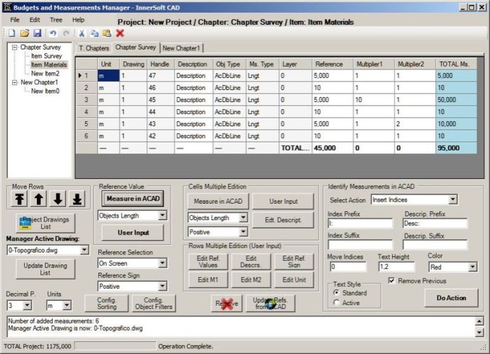
InnerSoft CAD is an efficient plug-in for AutoCAD that facilitates civil and survey-related tasks. Users can easily perform counting, estimating, and measuring functions as well as import/export data to/from MS Excel, streamlining their construction project budget management.

With this plugin, you can export Area/Length property values or coordinates for AutoCAD entities to an Excel sheet. You can also import vertex coordinates for both 2D and 3D polylines using one of three different methods.
InnerSoft CAD lets you import points or texts that have insertion points for each one, and extract all block definitions of a drawing in individual AutoCAD files, with each block definition in one file. You can also sum the area or length property of a set of objects, and the accumulated distance of a user-defined walk in the drawing.
The plugin can draw the longitudinal profile of a terrain or set of surfaces, triangulate a set of points, or mesh a model surface. You can take measurements on AutoCAD for construction project budgets, and create, open, or save different libraries containing a series of AutoCAD drawings (*.dxf or *.dwg) organized by books.
InnerSoft CAD can also draw a polyline graph, 2D & 3D convex hulls, lines, planes, circles, and spheres by regression from a selection of points. Furthermore, it can draw clothoids, parabolas, catenaries, circular transition curves, Wholly Transitional Curves, clothoid transition curves, and parabolic vertical transitions for complex geometric designs.
In summary, InnerSoft CAD offers a comprehensive set of tools that can help AutoCAD users streamline their workflow, make precise measurements, and create complex designs with ease.
Version 4.1: New tool to draw a catenary by sag or maximum deflection in AutoCAD.