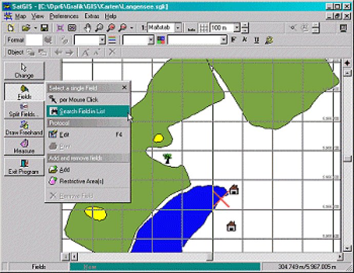
GPS-based field management made easy with graphical software.

One of the things I found most impressive about this software was its ability to import PalmArea-, PalmNav- and ESRI-Shape-Files with ease. This made it simple to bring in data from other sources and work with it alongside my own measurements.
Another standout feature of this software is its EU conform Field Protocol. This ensures that all your field data is compliant with EU regulations, so you can rest assured that you're using the latest and most accurate information.
Of course, no field management software would be complete without powerful printing options. Graphical Field Management delivers with its true-to-scale printing, which can be set to any scale you want. So whether you need to print out a single field or an entire farm map, this software has you covered.
On top of that, I appreciated the fact that all fields could be displayed on a single farm map. This made it easy to see everything at a glance and get a clear overview of my entire operation.
But the real power of Graphical Field Management lies in its ability to edit fields. You can easily split fields and change their colors, and the software recognizes restricted areas so you don't accidentally make any changes you shouldn't.
The software also includes a range of handy calculations for areas and distances, so you can get quick, accurate information on the fly. And if you need to add any custom symbols or drawings to your fields, the software has you covered with lots of flexible editing options.
Overall, I was extremely impressed with Graphical Field Management. Its comprehensive list of features, combined with its ease of use, makes it a top pick for anyone in need of a powerful field management software.
Version 0.3.0.6: N/A