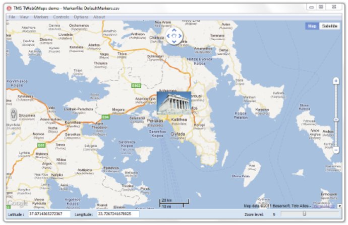
This VCL Component offers a highly customizable solution for incorporating Google Maps into VCL applications. A variety of map modes, including StreetView, are available, as well as features for displaying additional map information and adding position markers.

Moreover, you can also display extra information on the map, such as Bicycle View, Panoramio pictures, and Traffic information. You can select StreetView and add position markers to the map, including default Google balloon markers or your custom image markers.
Additionally, the software provides extensive configuration options, such as MapType control, OverViewMap control, Pan control, Scale control, StreetView control, and Zoom control. You can also create image files of the displayed map and save them in BMP, JPG, or PNG formats.
Furthermore, you can choose to enable or disable various mouse and keyboard options, such as panning, zooming, and mouse wheel scrolling. Also, the software includes the TWebGMapsGeocoding helper component, which facilitates conversions between address and longitude/latitude coordinates.
Overall, this VCL Component with extensive configurability makes integrating Google Maps in VCL applications a breeze, providing you with an easy-to-use and customizable solution.
Version 2.3.0.1:
- New : XYToLonLat function to convert XY to LonLat coordinates
- New : OnPolylineChanged event
- New : OnPolygonChanged event
- New : LonLatToXY function to convert LonLat to XY coordinates
- New : GetModifiedMapPolyline function to retrieve modified polyline coordinates