• Home
  • Most Popular
  • Submit
  • About Us
  • Contact Us

Softpile

Free Downloads

Categories
  • Home
  • Most Popular
  • Communications
  • Desktop
  • Games & Entertainment
  • Graphic Apps
  • Network & Internet
  • Security & Privacy
  • System Utilities
UTM Coordinate Converter 2.0.4
UTM Coordinate Converter software converts different Geographic Coordinate Systems like Latitude/Longitude and UTM. It also displays ...
UTM Coordinate Converter Mac Silicon 2.0.4
UTM Coordinate Converter is a software that allows the conversion between different Geographic Coordinate Systems, such ...
UTM Coordinate Converter Mac Intel 2.0.4
The UTM Coordinate Converter is a software that allows users to easily convert between different geographic ...
NTv2Poly 4.02
NTv2Poly is a spatial software that converts rectangular activity scope in NTv2 files into a Polygonal ...
NTv2Creator 2.09
The NTv2Creator software creates precise NTv2 files by comparing identical points in two distinct reference systems, ...
Maps Keeper for Google 1.0
This software is a user-friendly tool for creating customized maps based on Google Maps. It allows ...
OregonHotSprings.Immunenet.Com 1.0
Discover Oregon's top hot springs such as Bagby, Alvord, and Radium with our software guide. Explore ...
Home Education Geography AW Geographical Atlas Download

AW Geographical Atlas

March 26, 2005
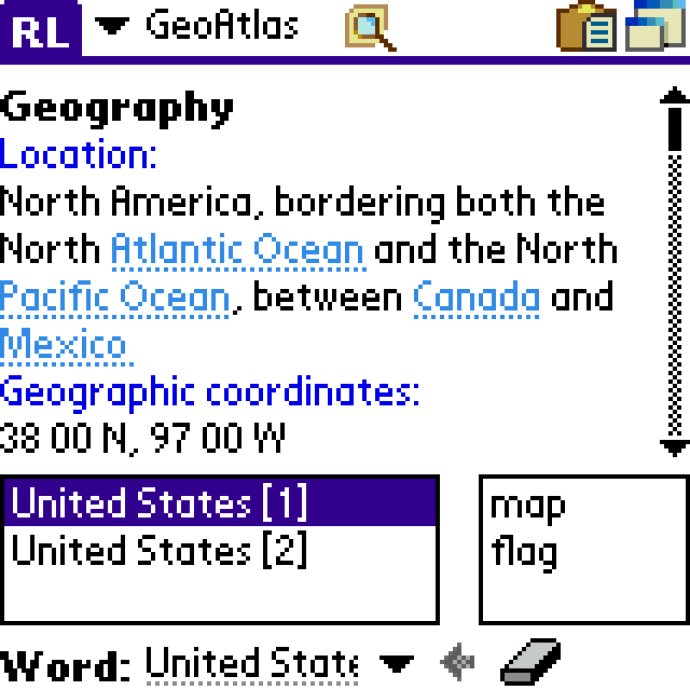
The Atlas software provides detailed information about countries including location, population, economy, and military. It features maps displaying country borders, neighbors, major cities, and rivers as well as flags of each country. Carry the world atlas with you everywhere!
AW Geographical Atlas
AW Geographical Atlas Screenshot
Version 3.0
License Shareware $19.95
Platform Palm OS
Supported Languages English
System Requirements Palm OS, 4518KB RAM
Free Version Limitations Information about 60 countries only
Homepage absoluteword.com
Developed by AbsoluteWord
If you want to deepen your knowledge about countries all over the world, the atlas software is an excellent option to keep as your reference. It provides comprehensive geographical information on each country, like their location, neighbouring countries, capital, population, economy, military, and more, including images of the country's flag and map.

This software can be very useful when you solve crossword puzzles, conduct study research, watch TV news, or simply get interested in geography. With detailed and well-organized information, the atlas software is cross-referenced and easy to use.

One of the best features of this software is its search function, which allows you to look up specific words or phrases within the atlas. This means you can quickly find all of the articles that contain the information you need.

Another great benefit of the atlas software is that it can be installed onto an expansion card. This option is ideal for those who want to save valuable space on their handheld device. Furthermore, the software supports modern devices with high-resolution screens, such as 320x320 or 320x480.

Overall, the atlas software is an exceptional tool for anyone who wants to learn more about the countries of the world. With its comprehensive information, ease of use, and search function, it's a must-have for anyone interested in geography.
What's New

Version 3.0: Added 2004 year data

flag map palm country city atlas
Free Download 4.4M
589
  • Share on:

Most Popular

  1. UTM Coordinate Converter Mac Intel 2.0.4
    42
  2. UTM Coordinate Converter Mac Silicon 2.0.4
    37
  3. OregonHotSprings.Immunenet.Com 1.0
    35
  4. NTv2Creator 2.09
    33
  5. NTv2Poly 4.02
    33
  6. Maps Keeper for Google 1.0
    33
  7. UTM Coordinate Converter 2.0.4
    31
  8. AW Geographical Atlas 3.0
    30

Related Downloads

UTM Coordinate Converter
UTM Coordinate Converter software converts different Geographic Coordinate Systems like Latitude/Longitude and ...
UTM Coordinate Converter Mac Silicon
UTM Coordinate Converter is a software that allows the conversion between different ...
Maps Keeper for Google
This software is a user-friendly tool for creating customized maps based on ...
NTv2Poly
NTv2Poly is a spatial software that converts rectangular activity scope in NTv2 ...
NTv2Creator
The NTv2Creator software creates precise NTv2 files by comparing identical points in ...
Copyright © 1999-2025 Softpile Free Downloads
  • Most Popular
  • Submit
  • About Us
  • Contact Us
  • Privacy Policy
  • Disclaimer
  • Terms of Use

Can we use your data to tailor ads for you?

Our partners will collect data and use cookies for ad personalization and measurement.

By choosing "I agree", closing this pop-up or clicking on any element on the page, you agree to the use of cookies to help us provide you with a better user experience.

Learn how Softpile and our partners collect and use data.

You can change your choice at any time in our privacy center.

Cookie Settings

Our website stores four types of cookies. At any time you can choose which cookies you accept and which you refuse. You can read more about what cookies are and what types of cookies we store in our Cookie Policy.

are necessary for technical reasons. Without them, this website may not function properly.

are necessary for specific functionality on the website. Without them, some features may be disabled.

allow us to analyse website use and to improve the visitor's experience.

allow us to personalise your experience and to send you relevant content and offers, on this website and other websites.