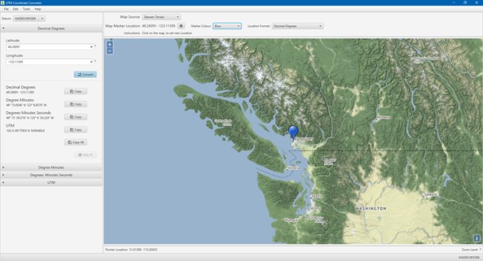
UTM Coordinate Converter software converts different Geographic Coordinate Systems like Latitude/Longitude and UTM. It also displays conversion results on a Map.

One of the key features of the UTM Coordinate Converter is its map display, which aids in location analysis. This map enables you to select a location you would like to convert, and it also displays the location you already converted. This feature is especially useful for users who require accurate location data for their work or personal use.
Another advantage of the UTM Coordinate Converter is its ability to convert between locations in Decimal Degrees, Degree Minutes, Degree Minutes Seconds and UTM. This flexibility means that users can easily convert their location data based on their specific needs or requirements.
This software also supports a wide range of UTM Datums, including NAD83/WGS84, GRS80, WGS72, NAD27, GDA94, AGD84, ED50, OSGB36, Krasovsky 1940, and Everest 1830. With such an extensive database, users can rely on the UTM Coordinate Converter to accurately and efficiently convert their location data.
Finally, the UTM Coordinate Converter uses OpenStreetMaps, which includes Mundialis, Mundialis Topo, Terrestris, Terrestris Grayscale, Stamen Terrain, Stamen Toner, Carto Light, Carto Dark and OpenTopo. This feature allows users to access a range of topographical maps to further enhance their location analysis.
Overall, the UTM Coordinate Converter is a must-have tool for anyone working with location data. Its effortless conversion process, map display, and robust database makes it an exceptional software for mapping and geo-location analysis.
Version 2.0.4:
Added GDA2020 Datum
Updated to Java 17.0.6
Added ability to check for updates
Other minor updates and fixes
Version 2.0.3:
Native support for macOS Silicon,
Added more Map Sources,
Updated to Java 17 (17.0.3),
Initial support for Linux (experimental),
Removed offline map cache (the feature wasn't working well),
Other minor updates and fixes