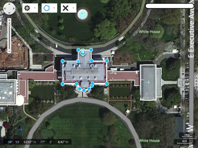
KLONK Map Measurement is a software tool that uses lines and shapes to measure distances and sizes of features on Earth. With this software, users can easily measure ground lengths using either a line or polygon shapes.

With Map Measurement, you can measure the length with a line or path and also measure areas using polygons. You can even measure multiple different measurements on one map. It's easy to use too! Simply open Map Measurement, navigate to a spot on the globe by zooming or entering an address in the search field of your interest.
Once you're ready to create a measurement, select the drawing method which you want to use - the latest used is already selected. Choose from Line, Path, or Polygon depending on your needs. To get started with your measurement, click a starting point on the map and continue clicking until you have drawn the figure that you want to measure.
End the drawing by right or double-clicking or by selecting the end drawing label. Note that line drawing automatically ends by the second point. You'll see a line or shape on the globe that shows what you are measuring. Overall, Map Measurement is a handy tool for anyone who needs to measure distances and areas on Earth simply and quickly.
Version 15.2.1.6: Initial version