HoudahGeo is a software tool that adds location data to your photos by geocoding and geotagging. It enables you to write GPS coordinates and location names to JPEG and RAW image files, allowing you to easily organize and share your travel memories as if captured by a GPS-enabled camera.

HoudahGeo writes both EXIF and XMP geotags to JPEG and RAW image files, creating a permanent record of where a photo was taken. One of the app's main features is the ability to add future-proof GPS tags to original images, making it an indispensable tool for preserving location information. HoudahGeo also integrates with Apple Photos, iPhoto, and Aperture libraries, just like a GPS camera.
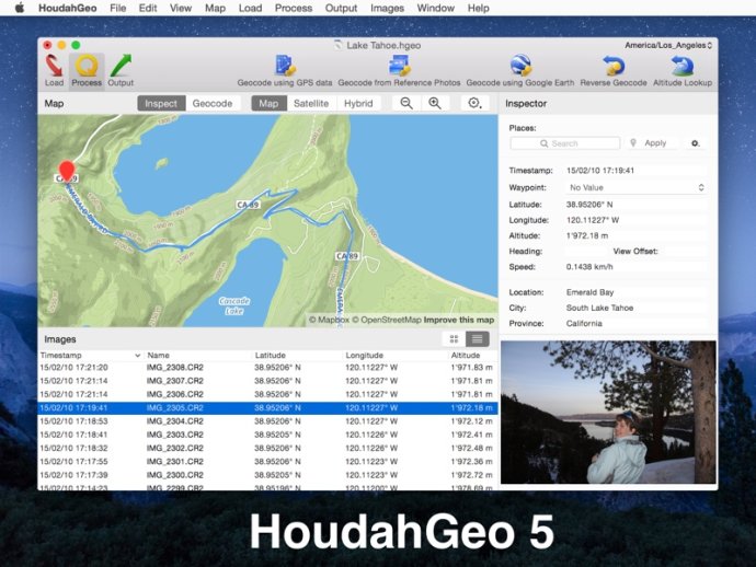
Geotagging with HoudahGeo is a breeze thanks to its simple 3-step workflow. Users can load their photos into a HoudahGeo project and optionally add GPS track logs for automatic geocoding. The built-in map allows them to assign or adjust photo locations and use reverse geocoding to add location names. Once done, they can write location information to original image files and export the project to view in Google Earth, Google My Maps, or Flickr.
HoudahGeo's feature highlights include the ability to write GPS data, location names, title, description, and keywords to EXIF, XMP, and IPTC tags. It works with JPEG, HEIF, and a large number of RAW file formats, and supports XMP sidecar files. The app also integrates seamlessly with Apple Photos, iPhoto, Aperture, and Adobe Lightroom Classic.
Users can automatically geocode using GPS track logs, reference photos taken using an iPhone or a GPS camera, or use the built-in map to double-check, adjust, or assign locations. Reverse geocoding fills in city, state, and country names, and HoudahGeo notifies Apple Photos, iPhoto, or Aperture when places information has been updated.
With HoudahGeo, users can create Google Earth KML and KMZ files to view their photos pinned along the path traveled. They can also publish photos and KML files to Dropbox and share images on a map or upload geotagged photos to Flickr. Overall, HoudahGeo is an essential tool for anyone who wants to keep track of their photo locations and other related information. With its intuitive interface and seamless integration with other apps, geotagging your photos has never been easier.
Version 6.4.3: * Adds support for Adobe Lightroom Classic 13
Version 6.4.2: * Fixes a bug with loading temperature values from UDDF dive log files
Version 6.4.1:
* Adds support for updated Nikon time zone tag
* Fixes a bug where image previews could fail to load
Version 6.4: Added support for WEBP image files
Version 6.3.3: Added support for Adobe Lightroom Classic 12